


The Great Smokey Mountains National Park is one of the most popular outdoor destinations in the entire U.S., drawing over 10 million visitors on an annual basis. Spread out over more than 500,000 acres, the park features 850 miles of trails and unpaved roads for hiking, as well as numerous campsites in both the front and backcountry. It is even home to a 70-mile section of the iconic Appalachian Trail, not to mention 16 mountains that exceed six thousand feet in height.
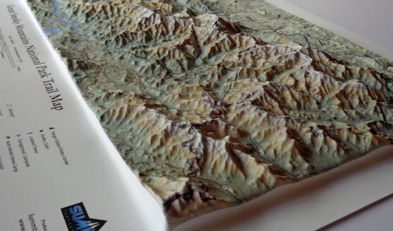
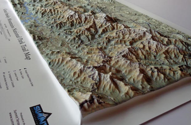
Now, a company called Summit Terragraphics, which specializes in making custom raised-relief maps based on topographic data, has created a miniature version of the Great Smokey Mountains in 3D. The new map measures 22″ x 15″ and comes in a scale of 1:180,000. That means that is covers the entire 521,085 acres of the park, complete with raised representations of mountains, hills, and valleys, completely to scale.
But that’s not all. The 3D map also lists every trail, campsite, ranger station, shelter, lake, river, and stream contained within the national park as well. In other words, it is an incredibly accurate miniature representations of the Great Smokey Mountains which has been created using a thermoform molding process that duplicates the rugged terrain in precise detail. In a sense, it is like having your very own version of the park that fits right in your hands.
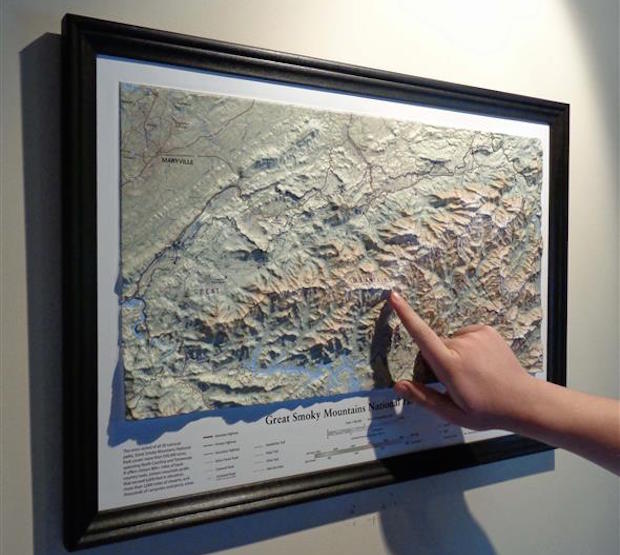
The unique new map would make an excellent Father’s Day gift. It sells for $19.95 at SummitMaps.com. Framed versions are also available for $59.95 and $69.95 depending on the choice of frames.